


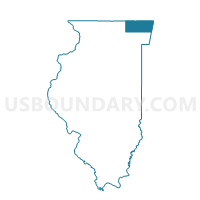
ELA 101 Voting District, Lake County, Illinois
About
Outline

Summary
| Unique Area Identifier | 572356 |
| Name | ELA 101 Voting District |
| County | Lake County |
| State | Illinois |
| Area (square miles) | 1.56 |
| Land Area (square miles) | 1.52 |
| Water Area (square miles) | 0.03 |
| % of Land Area | 97.90 |
| % of Water Area | 2.10 |
| Latitude of the Internal Point | 42.15986630 |
| Longtitude of the Internal Point | -88.06445650 |
Maps


Graphs
Select a template below for downloading or customizing gragh for ELA 101 Voting District, Lake County, Illinois


Neighbors
Neighoring Voting District (by Name) Neighboring Voting District on the Map
- ELA 100 Voting District, Lake County, IL
- ELA 102 Voting District, Lake County, IL
- ELA 104 Voting District, Lake County, IL
- ELA 99 Voting District, Lake County, IL
- Palatine 15 Voting District, Cook County, IL
- Palatine 49 Voting District, Cook County, IL
Top 10 Neighboring County Subdivision (by Population) Neighboring County Subdivision on the Map
Top 10 Neighboring Place (by Population) Neighboring Place on the Map
- Palatine village, IL (68,557)
- Lake Zurich village, IL (19,631)
- Kildeer village, IL (3,968)
- Deer Park village, IL (3,200)
Top 10 Neighboring Elementary School District (by Population) Neighboring Elementary School District on the Map
Top 10 Neighboring Secondary School District (by Population) Neighboring Secondary School District on the Map
Top 10 Neighboring Unified School District (by Population) Neighboring Unified School District on the Map
- Barrington Community Unit School District 220, IL (44,132)
- Lake Zurich Community Unit School District 95, IL (31,319)
Top 10 Neighboring State Legislative District Lower Chamber (by Population) Neighboring State Legislative District Lower Chamber on the Map
Top 10 Neighboring State Legislative District Upper Chamber (by Population) Neighboring State Legislative District Upper Chamber on the Map
Top 10 Neighboring 111th Congressional District (by Population) Neighboring 111th Congressional District on the Map
Top 10 Neighboring Census Tract (by Population) Neighboring Census Tract on the Map
- Census Tract 8036.08, Cook County, IL (7,326)
- Census Tract 8644.10, Lake County, IL (5,219)
- Census Tract 8644.03, Lake County, IL (5,206)
- Census Tract 8644.12, Lake County, IL (4,156)